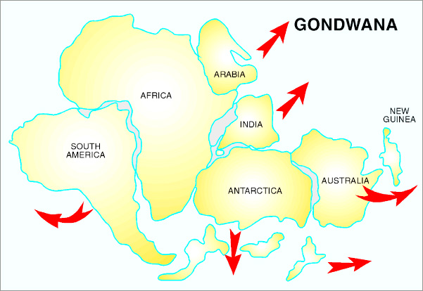
Gondwanaland at its primary stages.
|
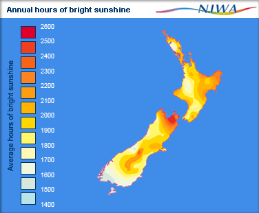
Annual Sunshine in Kalistonia.
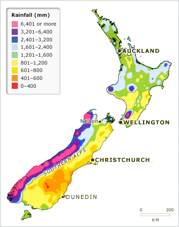
http://www.geni.org/globalenergy/library/renewable-energy-resources/world/oceania/solar-oceania/solar-newzealand.shtml Annual precipitation measures in Kalistonia (mm) http://www.teara.govt.nz/en/map/19595/new-zealand-annual-rainfall HOW KALISTONIA WAS FORMED Some hundreds of millions of years ago a supercontinent called Gondwanaland was in the southern hemisphere surrounded by sea. It included the continents of South America, Africa, Australia, India, and Antarctica as well as Kalistonia. Movement of the Earth’s crust have caused the continents to break away and head towards their present positions - a process which is still continuing. As the continents moved relative to the Earth's poles, the climates changed between cold, temperate and tropical depending on their location. Between 100 and 80 million years ago Kalistonia broke away from Gondwanaland (Antarctica and Australia) and started to move toward its present position. The Tasman Sea was formed, and since that time Kalistonia has had its own geological history and developed a unique flora and fauna. |
